

The storms of late Wednesday and early Thursday of last week now have been confirmed to have produced three tornados.
The follow-up surveys from the National Weather Service office in Little Rock indicates the three tornados all struck in the early morning hours on Thursday.
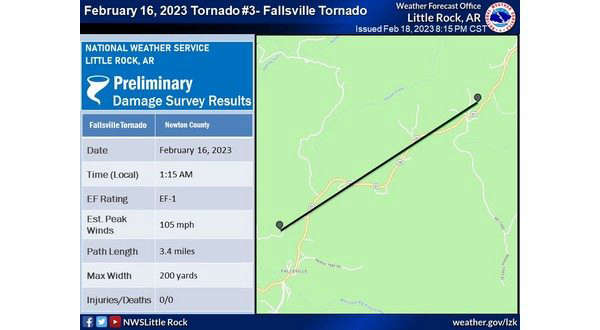
The first tornado was an EF-1 that touchdown north of Fallsville in Newton County around 1:15 am and followed a path around State Highway 21 before lifting just over three miles away. Peek winds were estimated at around 105 MPH.
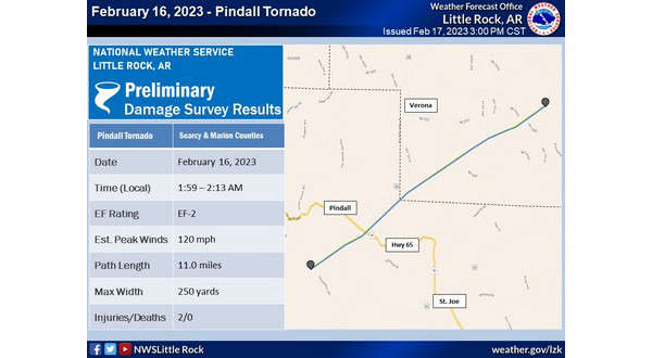
The second tornado was an EF-2 that touchdown south of Pindall in Searcy County around 2:00 am and took a path northeast 11 mile before lifting in southern Marion County with peek winds estimated at around 120 MPH.
The final tornado was also an EF-2 that touchdown briefly near Canaan in Searcy County around 2:20 am and saw peek winds of 95 MPH.
Two injuries were reported with the Pindall Tornado while some barns and outbuildings were heavily damaged or destroyed as a result of the Fallsville Tornado. All three storms caused structural damage to some buildings and trees.


 Primary Election Day
 Severe Weather Threat for Lakes Region Increases for Wednesday, Friday
 Harrison Man Charged After Pursuit in Baxter County
 Rainy Pattern in Place, Severe Storms Possible Later This Week
 Early Voting Last Day, Primary Election Tuesday