

The Christmas Week that saw record high temperatures in the region gives way to a blast of cold to start New Year’s Week.
Christmas Week saw several records fall, including an over 130-year-old record high for Springfield on Christmas Day. In to the early part of the weekend, temperatures stayed warm with some parts of the Lakes Region reaching 80 degrees on Saturday.
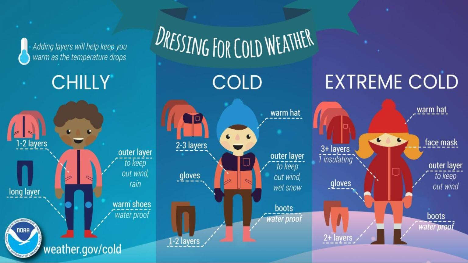
A cold front moved through Sunday afternoon dropping temperatures drastically with this morning’s low temperatures in the upper teens with wind chills in the single digits.
High temperatures today will reach only the low 30s and though winds will die down during the day, wind chills will remain in the teens.
The National Weather Service predicts a quick warm-up as highs rebound to the 40s and Tuesday then into the 50s through the rest of the New Year’s Week.


 Primary Election Day
 Severe Weather Threat for Lakes Region Increases for Wednesday, Friday
 Harrison Man Charged After Pursuit in Baxter County
 Rainy Pattern in Place, Severe Storms Possible Later This Week
 Early Voting Last Day, Primary Election Tuesday