

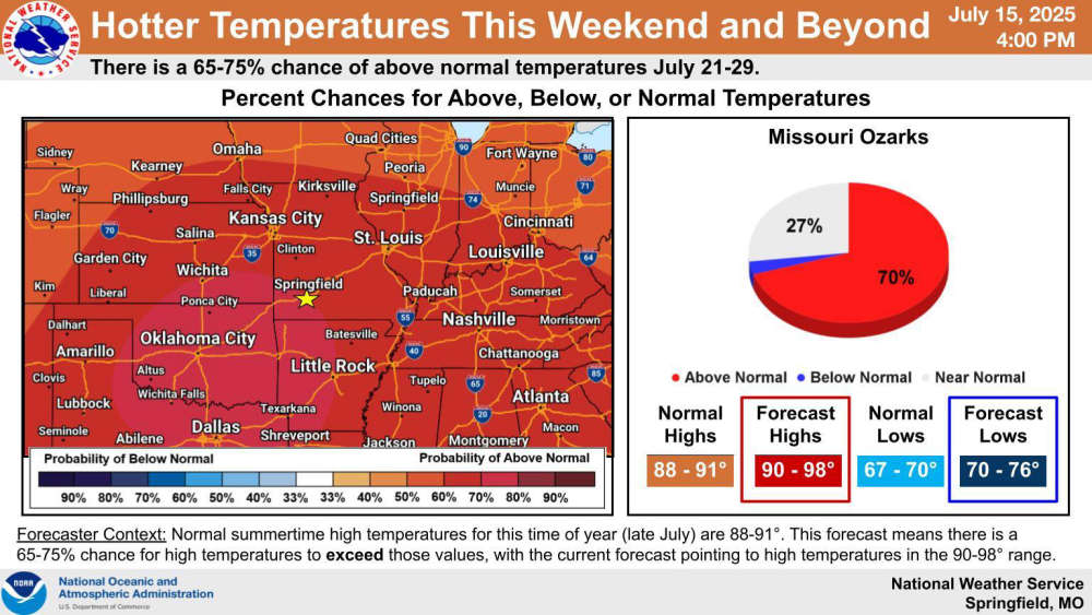
The pattern of scattered showers and thunderstorms will continue until the end of the week to then be replaced by a ridge of high pressure that will decrease the rain chance and increase temperatures.
The National Weather Service forecast says the stationary front that has parked itself over the region will be pushed north which will make way for warmer air from the south to increase temperatures into the mid to upper 90s into next week.
While rain is still in the forecast the rest of this week, highs will be in the low 90s with heat index readings around 100 in some areas.


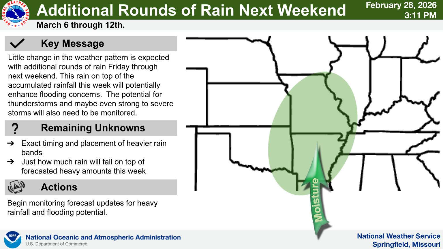
 Rainy Pattern in Place, Severe Storms Possible Later This Week
 Early Voting Last Day, Primary Election Tuesday
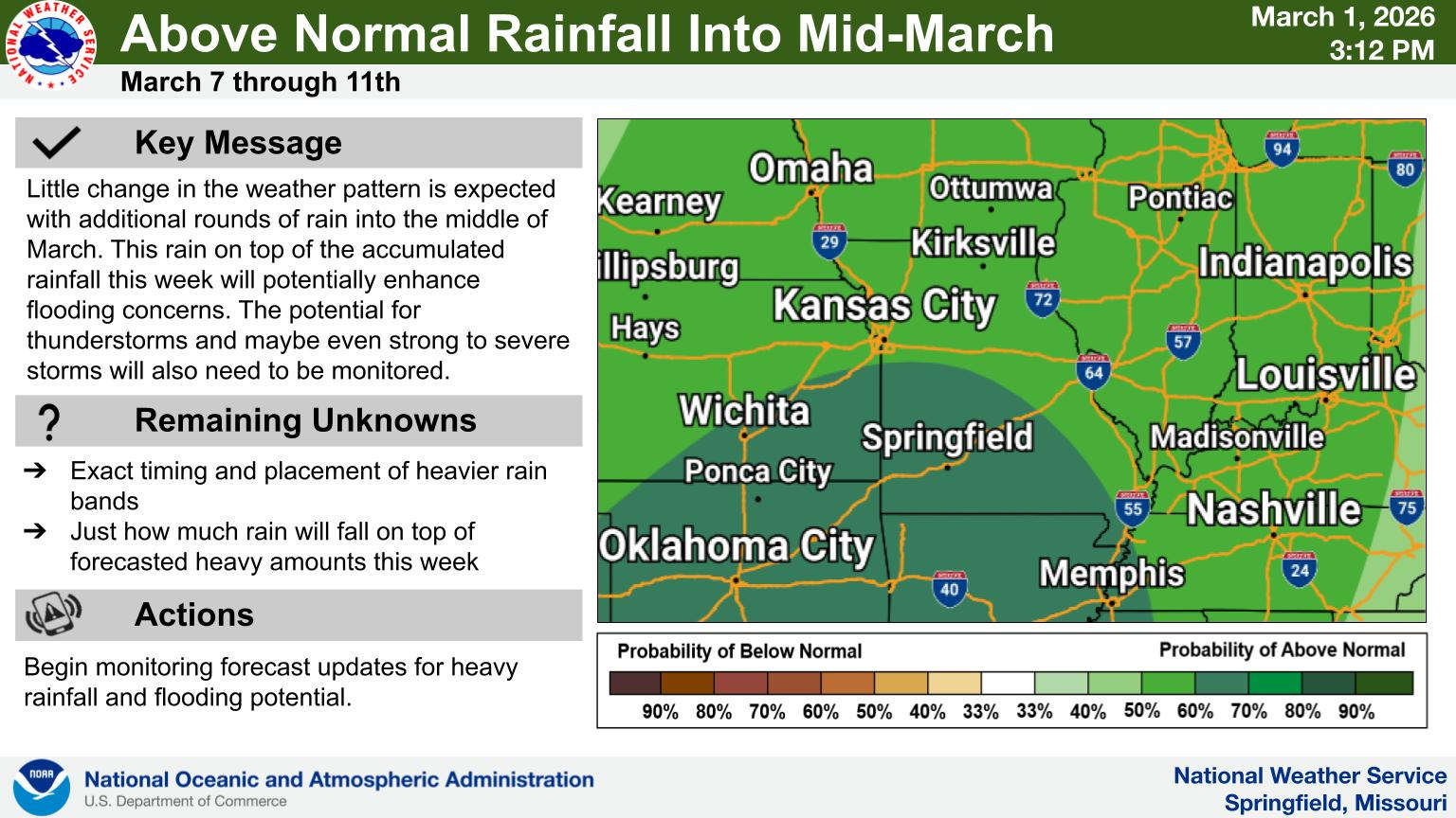
 Rain Pattern Continues Through the Week
 Thousands Attend Service for Fallen Deputies
 Judge Latest Arrest in Investigation of Boone County Public Corruption