

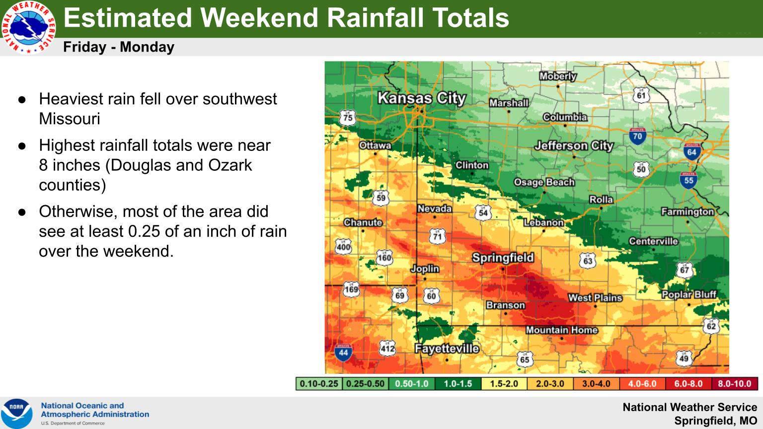
Showers and thunderstorms dominated the Memorial Day Weekend with several areas seeing a large amount of precipitation.
According to the National Weather Service, the heaviest rain fell in an arena inside a circle with Springfield on the northern boundary, Branson on the west, Mountain Home on the south, and West Plains on the east boundary. Some areas within that boundary saw four to six inches of rain with isolated amounts between seven and eight inches.
There were flooding issues in other areas including along the James River at Galena. The National Weather Service had Flood Warnings for the waterway during the weekend which saw river levels get up to around 24 ft., nearly 10 ft. above Flood Stage. According to an Ozarks First report, several camping businesses along the river had to close due to the flooding while others dealt with the debris that traveled the river during the flood. Water levels have begun to drop along the James River so the Flood Warning for the area has been lifted by the NWS.
Another area that has seen major impact is the Buffalo National River, with several parts of the river well above Flood Stage due to the continuous rain.
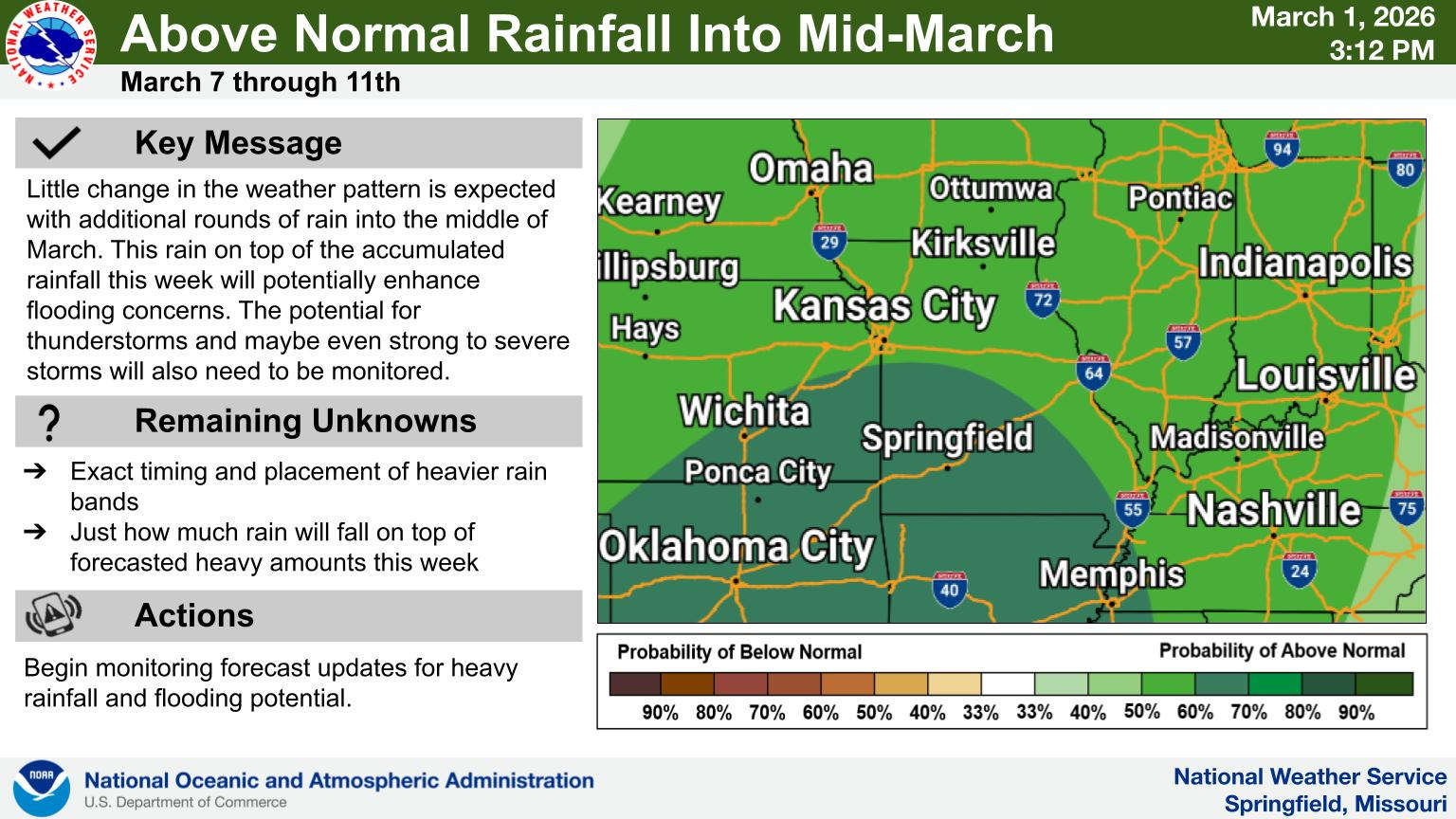
Rain is slowly exiting the area today with drizzle and scattered thunderstorms possible. After a dry Wednesday, another round of precipitation is expected Thursday before an extended dry period begins on Friday.


 Primary Election Day
 Severe Weather Threat for Lakes Region Increases for Wednesday, Friday
 Harrison Man Charged After Pursuit in Baxter County
 Rainy Pattern in Place, Severe Storms Possible Later This Week
 Early Voting Last Day, Primary Election Tuesday