

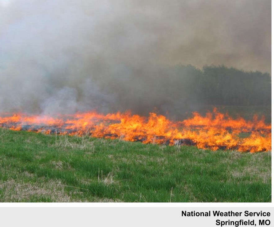
National Weather Service forecasters in the region continue to warn of an elevated fire risk due to high winds and low humidity.
While a cold front shifted the winds to lead to a chilly start to the morning, the winds will shift back from the south and increase again late this afternoon into the evening. Despite yesterday’s rain, conditions remain overall dry and fire risk does remain high.
Saturday’s high will surge into the 60s before another brief cool down on Sunday leads to even warmer temperatures with highs expected into the 70s for much of the week including Christmas Day.


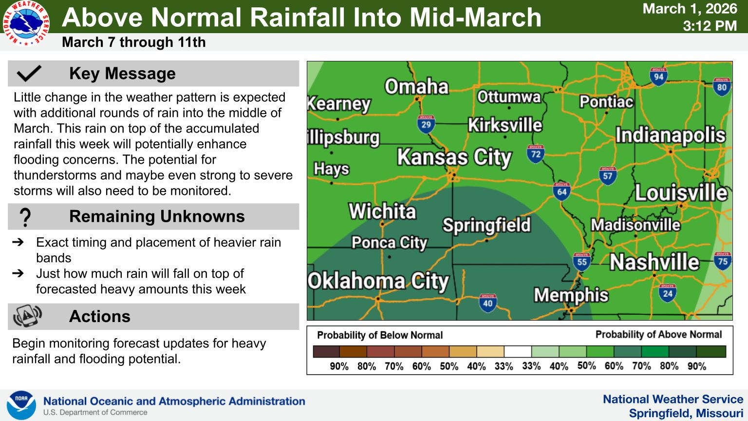 Rainy Pattern in Place, Severe Storms Possible Later This Week
 Early Voting Last Day, Primary Election Tuesday
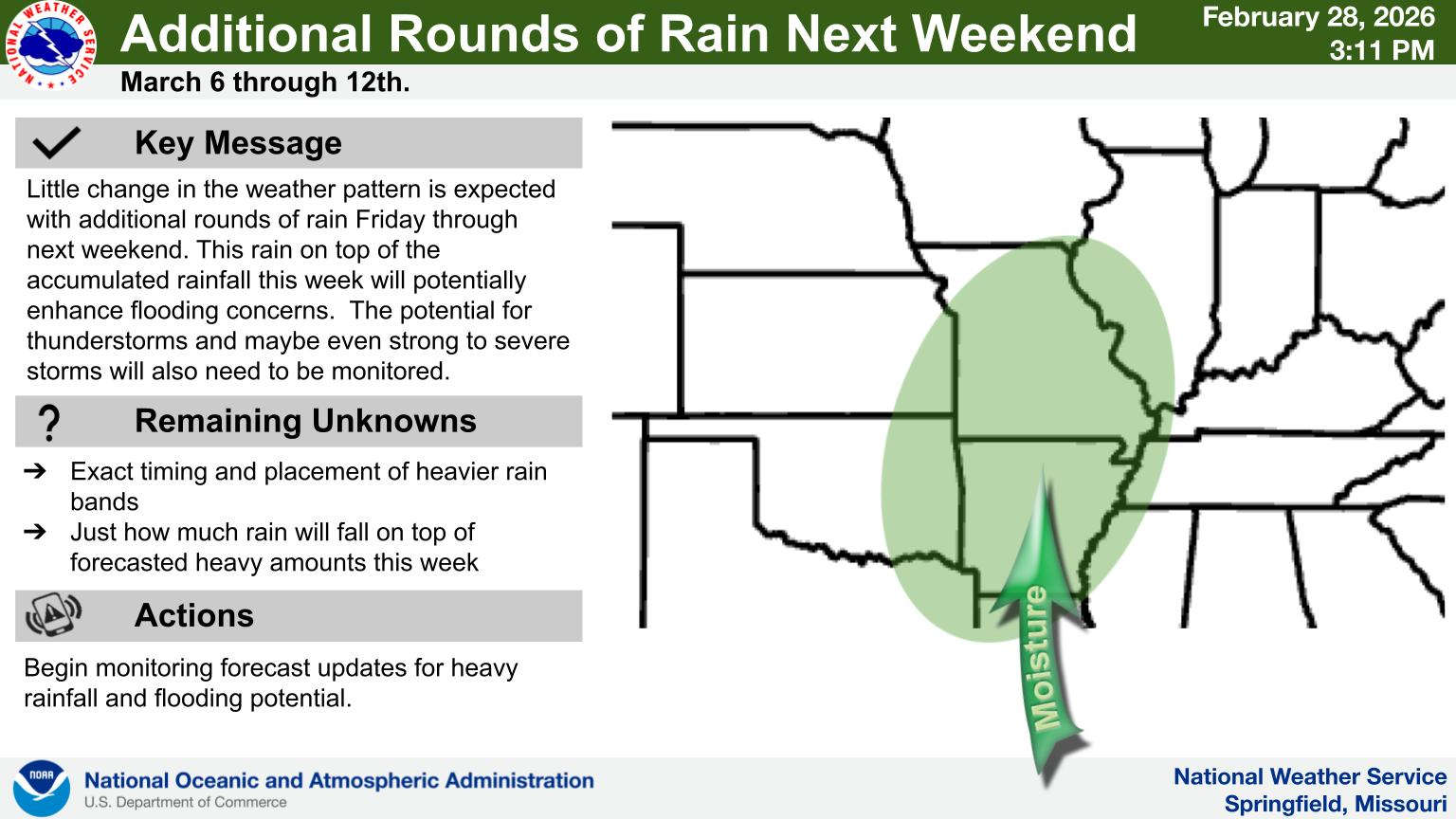 Rain Pattern Continues Through the Week
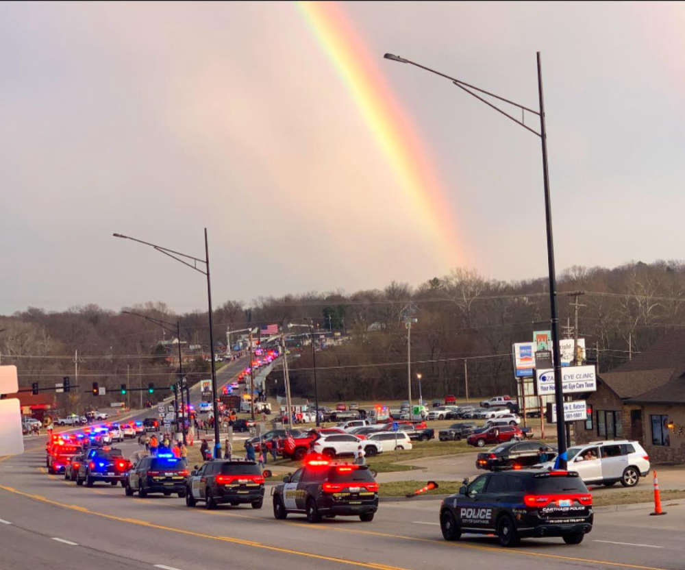 Thousands Attend Service for Fallen Deputies
 Judge Latest Arrest in Investigation of Boone County Public Corruption