

A break for most from the showers and thunderstorms today before another round moves through tonight and Friday.
The National Weather Service predicts today to be mostly dry with just a slight chance of a scattered shower. Rain does redevelop tonight into Friday before moving out by early Saturday morning leading into a dry weekend.
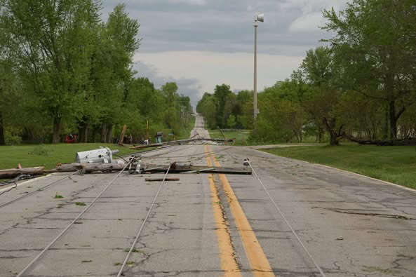
The break will also help recovery efforts from the severe line of storms that moved through on Tuesday, causing extensive damage in the Springfield area. Springfield City Utilities reports on their Facebook page Wednesday night that the number of customers still without power is 14,500 and crews are working round the clock to get power back. CU reported around 50,000 were impacted by the storms. Several other communities also dealt with power outages after the storms moved through Tuesday morning. The outage was the largest in Springfield since the 2007 Ice Storm.
While a pair of tornados were formed with the passage of the squall line, NWS Forecasters say the damaged caused in Springfield and Greene County was the result of a straight-line wind which saw gusts of 80-90 MPH in part of the county.


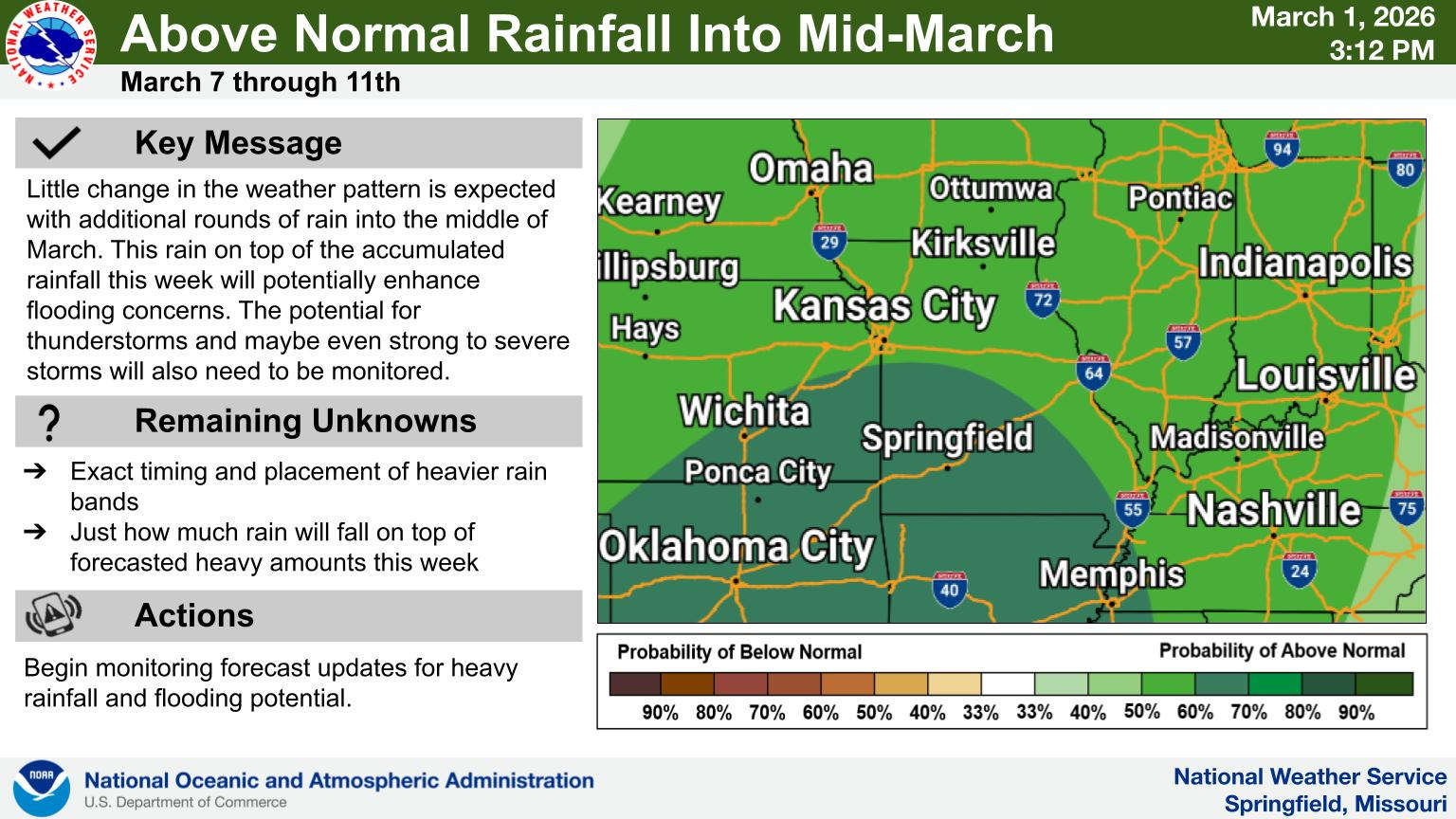 Rainy Pattern in Place, Severe Storms Possible Later This Week
 Early Voting Last Day, Primary Election Tuesday
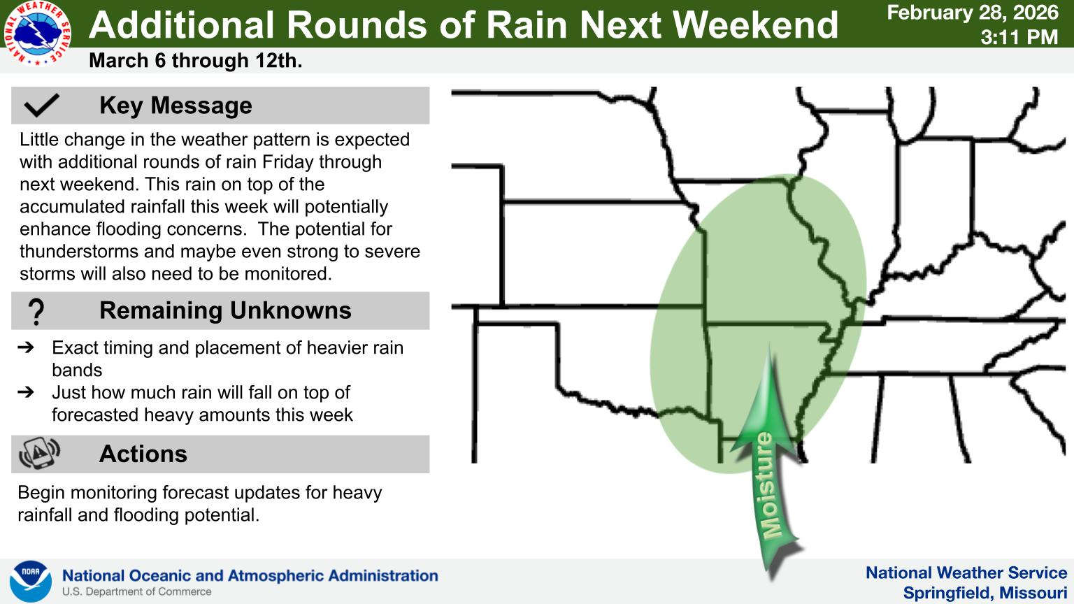 Rain Pattern Continues Through the Week
 Thousands Attend Service for Fallen Deputies
 Judge Latest Arrest in Investigation of Boone County Public Corruption