

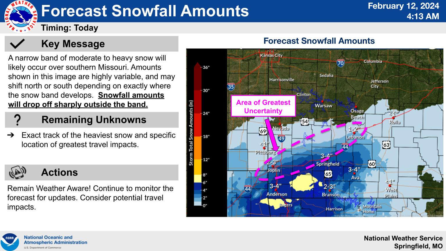
While Winter Storm Warnings do remain in effect for the region, the area forecast for the heaviest snow has shifted.
According to the latest information from the National Weather Service, the heaviest snow is forecast for areas west of Branson in Barry and Stone Counties. Areas west of a Branson to Harrison line could see a potential four to six inches of snow while areas east of that line fall in the two to four inch area. Accumulations will vary due to temperatures at or slightly above freezing.
Some area schools have already closed classed for today in anticipation of potential snowfall. The cancellation page on our website will update that information as new closings come in.


 Harrison Voters Split on Sales Tax Renewals, Other Election Results
 National Nutrition Month: "The Power of Nutrition"
 Court Documents Filed with Details on Missing Boone County Funds
 Primary Election Day
 Severe Weather Threat for Lakes Region Increases for Wednesday, Friday