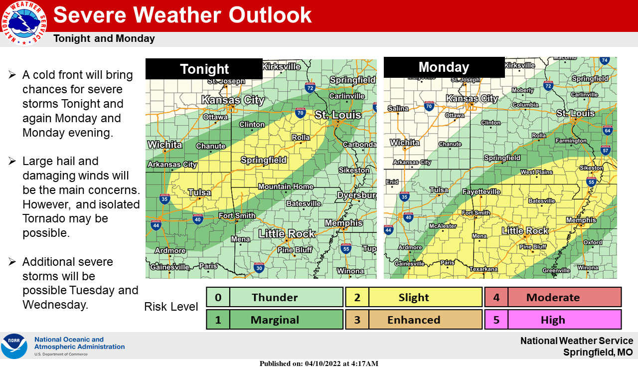
Several days of unstable weather are possible in the Lakes Region beginning tonight.
The National Weather Service says a warm front along with moisture from the Gulf will lead to conditions that make severe thunderstorms a possibility with strong winds and hail the biggest threat. Isolated tornados are also a possibility.
The strong winds will begin in the region this afternoon with counties in northern Arkansas including Boone, Carroll, Marion, Newton, and Searcy under a Wind Advisory with Gusts possible up to 40 MPH. Storms are possible late tonight with most of the severe weather expected in the overnight hours into Monday morning.
Storm chances continue during the day Monday then after a break Tuesday afternoon, ramp back up Tuesday night into Wednesday before finally clearing out with cooler temperatures Thursday and Friday.
 Hotter Today but Cooldown for Wednesday UPDATE
 Employees Still Waiting to Hear From Branson Tri-Lakes Newspaper Management
 Informational Meeting About Fire and Police Tax Thursday
 Tick Season Is in Full Force
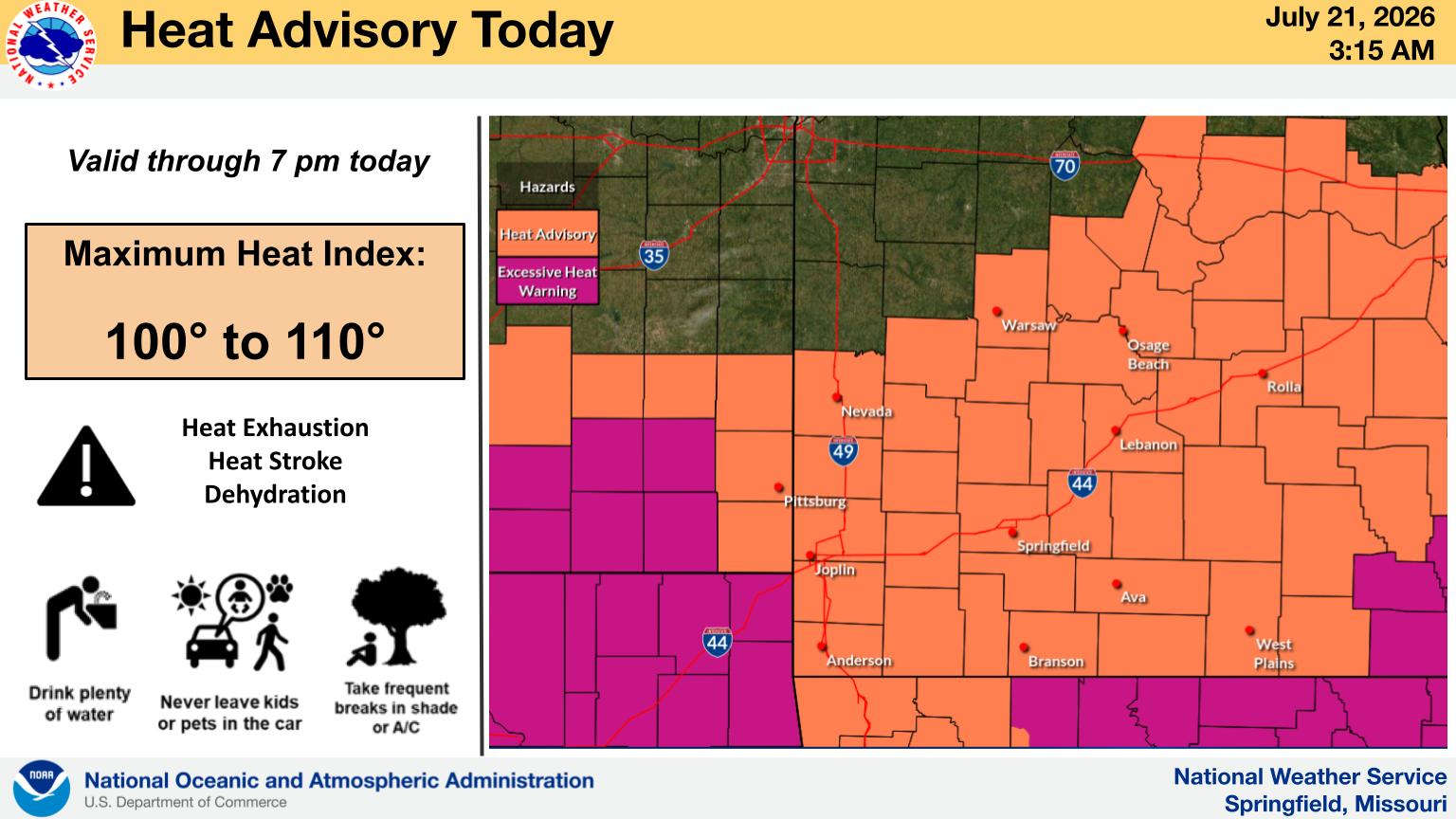
 What is the Potential Heat Index Readings for This Week? Update


