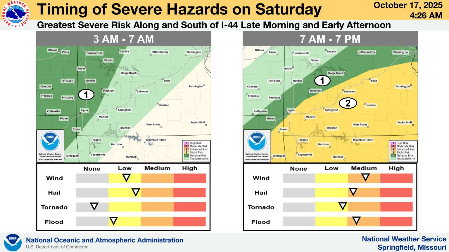
Today could be the last day of 80 plus degree temperatures in the Lakes Region for a while.
The National Weather Service says a frontal system will push through the area beginning early Saturday morning, bringing with it a slight chance of severe thunderstorms. Strong winds and hail are the primary threats with the storms. Some areas could see heavy rain with an inch to an inch and half possible.
The stormy Saturday will bring much cooler temperatures to the Lakes Region with Sunday highs only in the 60s before settling into the 70s next week. Lows are expected in the upper 40s into the 50s.
 What is the Potential Heat Index Readings for This Week? Update
 Warriors Retreat Holds Ribbon Cutting
 Lettuce Recall Continues, Expands
 Harmon Fire Department Awarded Matching Grant
 U of O Northark Movie Night Features Movie in Star Wars Series


