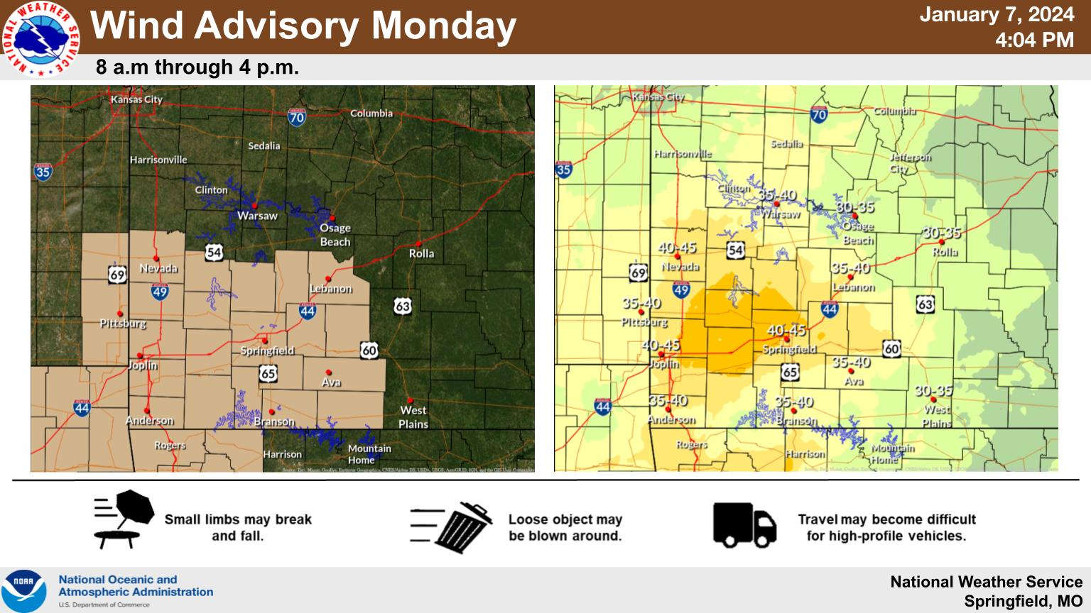
A storm system will bring rain and wind to the region today and could possibly lead to snow before the system leaves the area on Tuesday.
The National Weather Service has issued a Wind Advisory for the region today with possible southerly wind gusts to 40 and 50 MPH possible during the day. In addition, rain moves into the region during the afternoon with some heavy rain possible before decreasing in intensity to drizzle and light rain during this evening.
More rain and wind on Tuesday with rain changing to snow during the afternoon. Forecasters believe most of the Lakes Region could see up to an inch of accumulation while strong wind could lower visibility due to blowing snow.
No Winter Weather Advisories are in effect for the Lakes Region with most of the winter weather impacts expected to be north of Springfield.
 What is the Potential Heat Index Readings for This Week? Update
 Warriors Retreat Holds Ribbon Cutting
 Lettuce Recall Continues, Expands
 Harmon Fire Department Awarded Matching Grant
 U of O Northark Movie Night Features Movie in Star Wars Series


