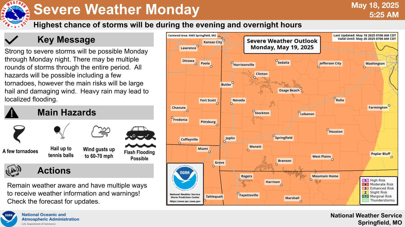
The National Weather Service continues to refine the forecast for potential severe weather in the Lakes Region.
While a Slight risk continues for today, the entire Lakes Region and surrounding areas are now under an Enhanced, or Level 3 out of 5 Risk for severe weather on Monday. Current trends see for a break in rain this afternoon with more developing tonight into Monday morning before another break.
Instability is expected to build during the morning and afternoon as storms will begin to redevelop mid to late afternoon into the evening hours where the strongest storms are expected. All modes of severe weather are possible along with some possible flash flooding.
 Informational Meeting About Fire and Police Tax Thursday
 Tick Season Is in Full Force
 What is the Potential Heat Index Readings for This Week? Update
 Warriors Retreat Holds Ribbon Cutting
 Lettuce Recall Continues, Expands


