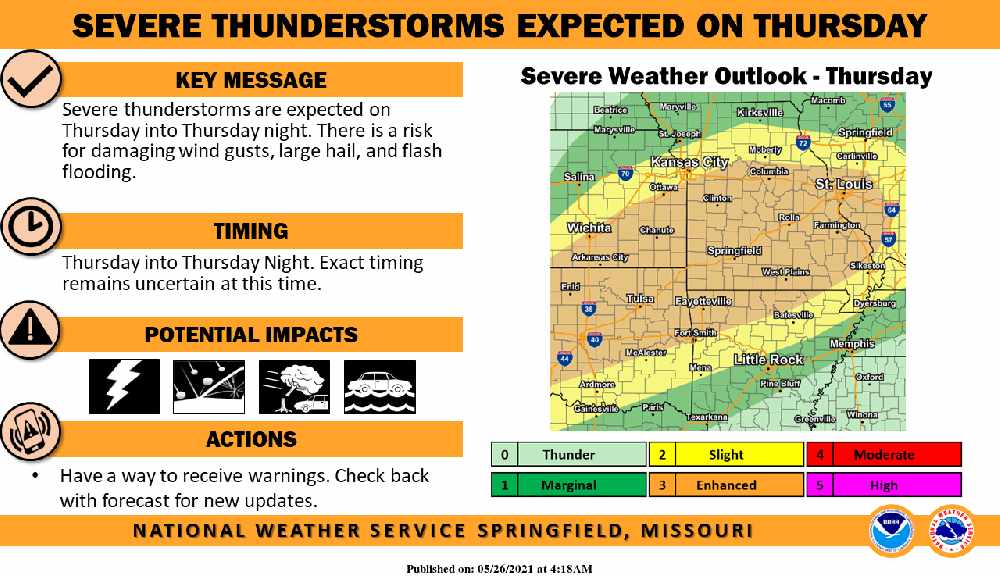
Much of Northwest Arkansas and Southwest Missouri could see a round of Severe Weather on Thursday.
Forecasters for the National Weather Service say that Thunderstorm development will build on Thursday afternoon into the evening with Damaging Winds, Large Hail, and Flash Flooding the biggest risks.
Much of the region will see a break in the rain today with just chances of scattered showers before Thursday’s Severe Potential. Forecasters say much of the upcoming Memorial Day Weekend will be dry with a chance of some showers redeveloping on Monday.
 Burn Bans Accompany Low Water Conditions
 Searcy County Election Commissioners Resign Over Voter Data Concerns
 Law Enforcement Seeking Information on Deadly Beaver Lake Accident
 Murder Suspect Arrested in Lakes Region Identified


