
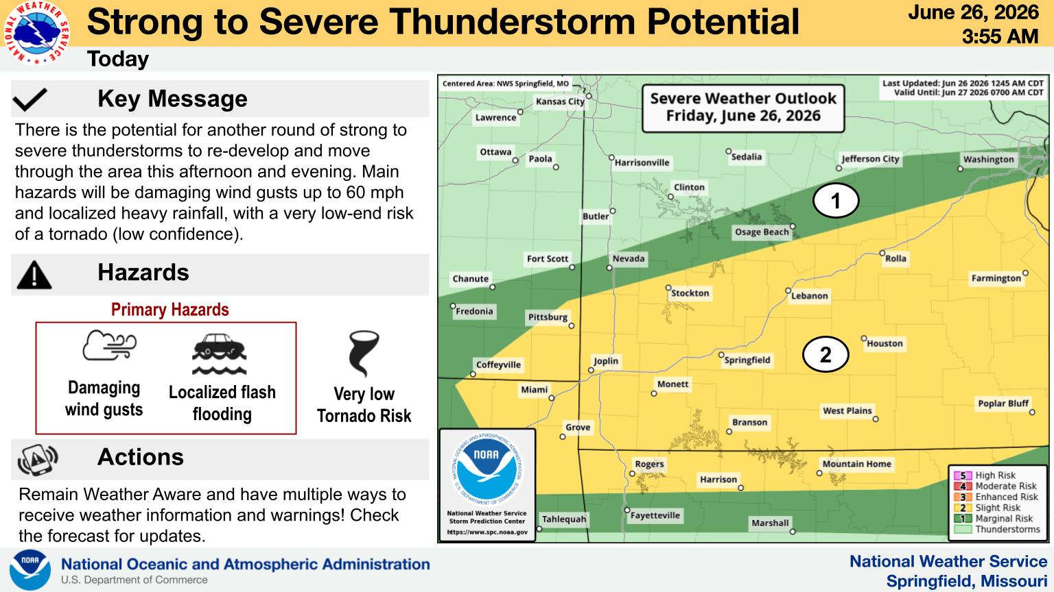
A week of summertime heat will end today with a chance of severe thunderstorms prior to the cooler temperatures.
A slight to moderate risk of severe thunderstorms are possible this evening into Saturday morning as a cold front moves through the region. Large hail and strong winds are the main threat along with some localized flooding.
After a break in the rain Saturday, another round of thunderstorms are possible on Sunday with some severe storms possible.
 Boil Order Issued for Area Water District
 When the Rain will End and Hot Temperatures Arrive in the Lakes Region?
 Harrison City Council Gives Initial Approval to Placing Sales Tax on Ballot
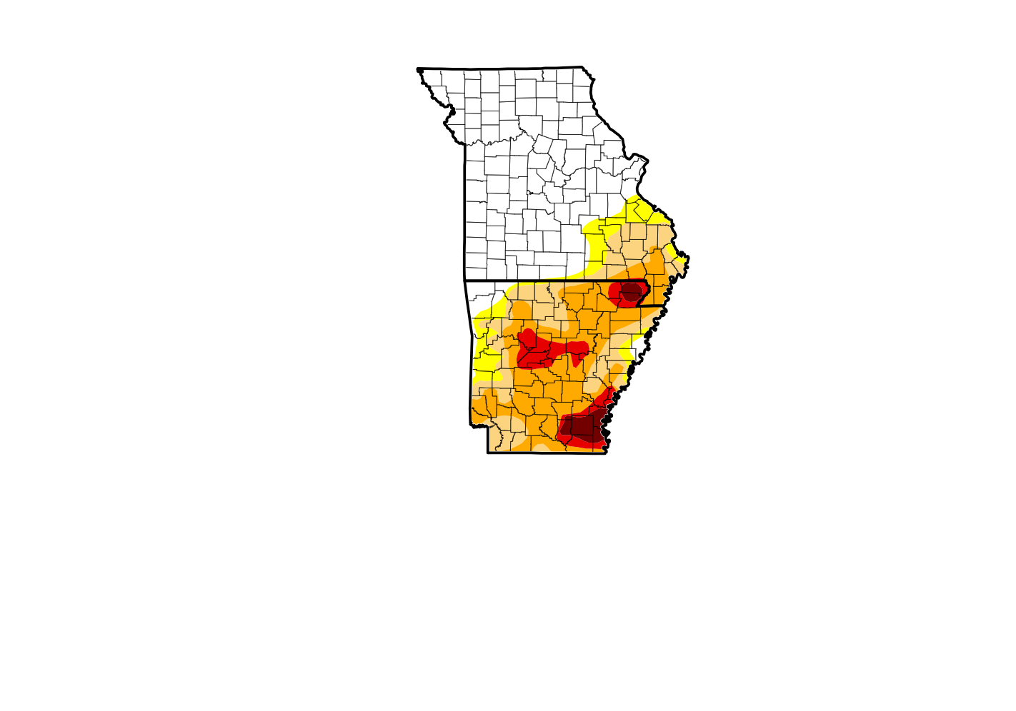 How Much More Drought Levels Have Dropped Due to Continued Rainfall
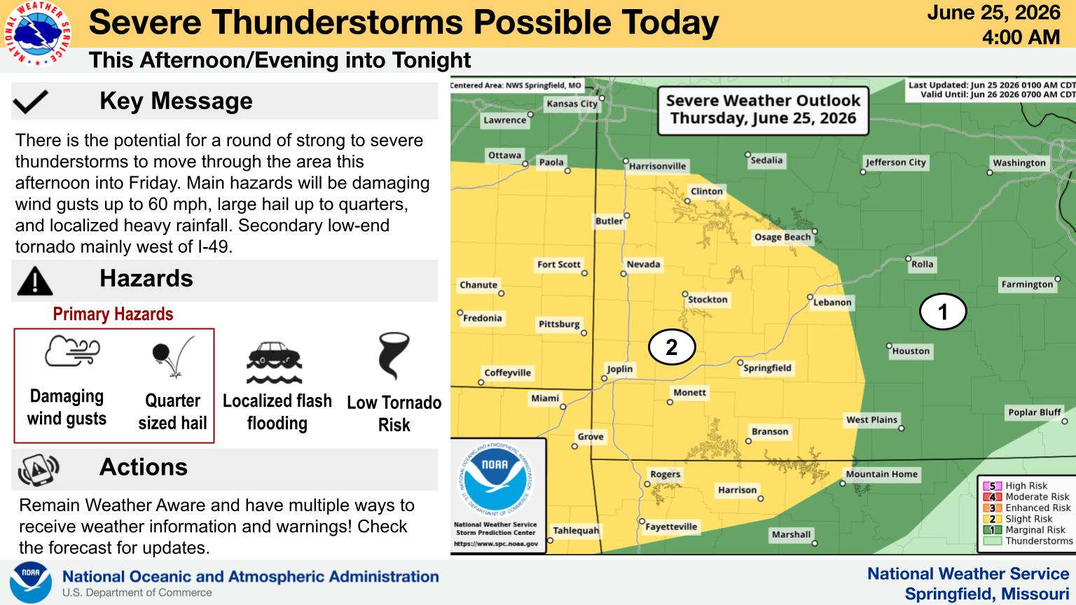 Flood Watch Extended into Lakes Region, Severe Weather Possible


