As temperatures get close to record highs, conditions are developing for the return of severe weather to the Lakes Region.
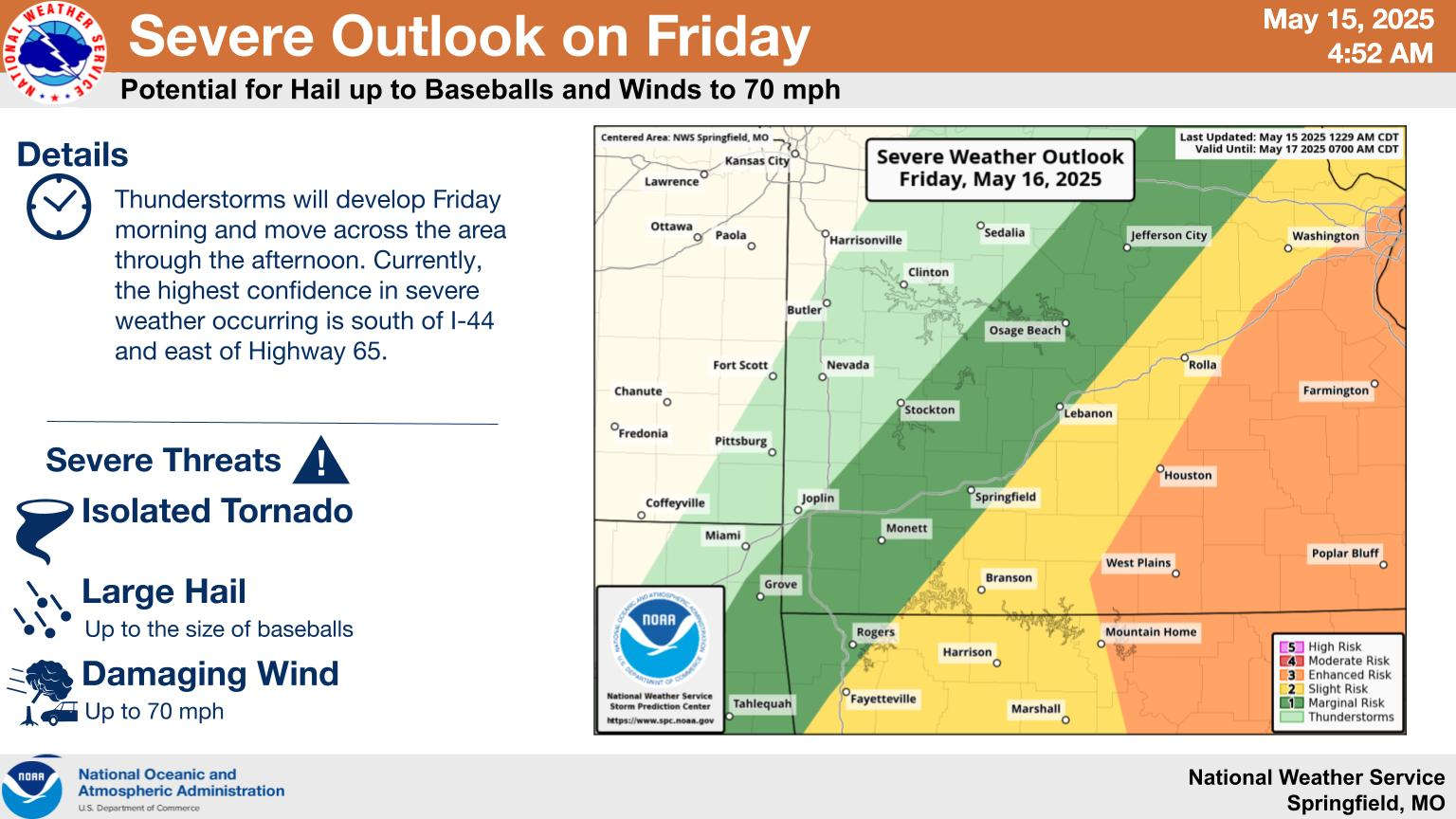
While most areas will remain dry today, there is a slight chance of thunderstorms with a Marginal risk of severe storms. Rain chances increase Friday as do the chances of severe weather with a Slight risk throughout the Lakes Region. Large hail, damaging winds, and isolated tornados are possible.
A break in the thunderstorms is forecast for Saturday before a more general area of precipitation is expected on Sunday. High Temperatures will remain in the 80s through the weekend.
 Informational Meeting About Fire and Police Tax Thursday
 Tick Season Is in Full Force
 What is the Potential Heat Index Readings for This Week? Update
 Warriors Retreat Holds Ribbon Cutting
 Lettuce Recall Continues, Expands


