UPDATE 3: With another round of thunderstorms moving into the region, the National Weather Service has issued a Severe Thunderstorm Watch through early Sunday morning for both the Branson and Harrison areas.
UPDATE 2: Barry, Stone, Carroll, and Madison Counties are under a Tornado Watch until 11:00 pm. A Flash Flood Warning is also in effect for parts of Boone, Marion, Newton, and Searcy Counties until 10:00 pm.
UPDATE: Taney and Ozark Counties, including the Branson area, have bee added to the Flood Watch in effect for today into Sunday morning. In addition, a Flood Warning has been issued for the James River between Boaz and Galena for Sunday due to expected rises in the river.
The Lakes Region will a variety of weather conditions today.
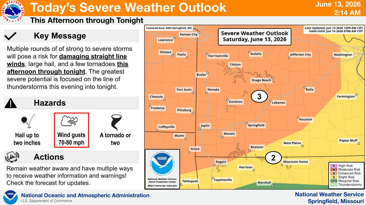
The National Weather Service has a Level 3 or Enhanced Risk of severe storms areas northwest of a Branson to Rogers line which covers most of Table Rock Lake while the rest of the Lakes Region is at a Level 2 or Slight Risk of severe weather.
The first round of storms this morning has stayed north of the Lakes Region though another round is expected to develop this afternoon and evening bringing with it the potential of straight line winds or tornados and large hail.
In addition to the severe storms, heavy rain is possible in parts of the region. Currently, a Flood Watch is in effect for parts of southern Missouri and northern Arkansas. While neither Branson or Harrison are included in the watch, Stone and Barry Counties in Missouri along with Carroll and Madison Counties in Arkansas including most of Table Rock Lake are in the Flood Watch Area. Several inches of rain are possible as these showers move through the region today into tomorrow morning.
Rain is expected to end by Sunday afternoon with much cooler conditions over then next couple of days with highs in the 70s and lows in the 50s.
 Law Enforcement Seeking Information on Deadly Beaver Lake Accident
 Murder Suspect Arrested in Lakes Region Identified
 Front Storms Area, Brings End to Heat
 Springfield Murder Suspect Arrested in Lakes Region
 Final Hot Day Ahead of Front Bringing Cooler Temperatures, Rain


