

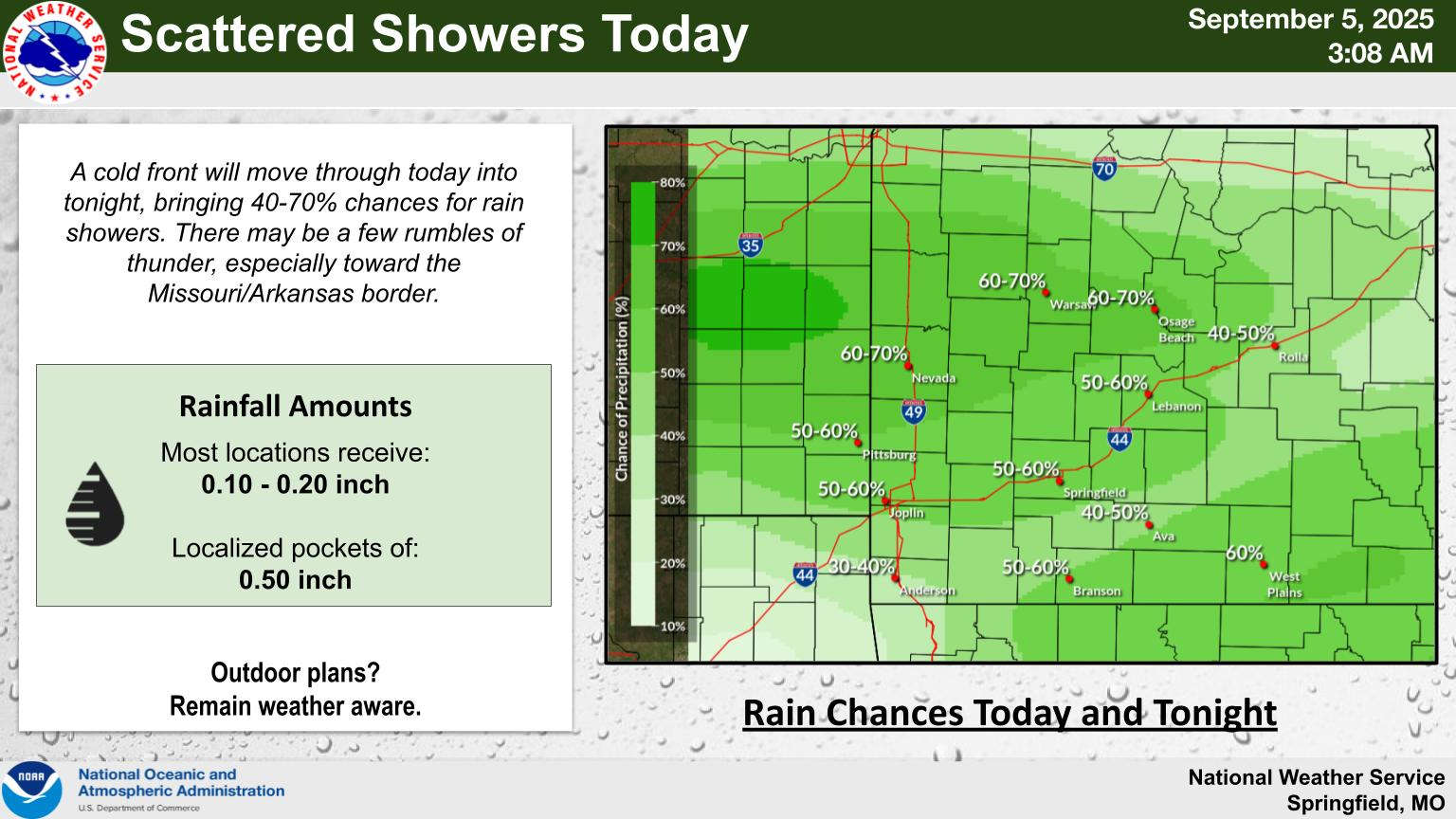
The recent cool pattern continues through the weekend with rain today, but the Lakes Region is not done with summer like temperatures yet.
The National Weather Service says a front will move through today bringing with it a chance of showers and thunderstorms through the afternoon and evening. The frontal passage will give way to a dry weekend with temperatures staying in the 80s.
Forecasters predict next week for things to warm-up again with highs possibly back into the 90s by Wednesday with no rain in the forecast for that period.


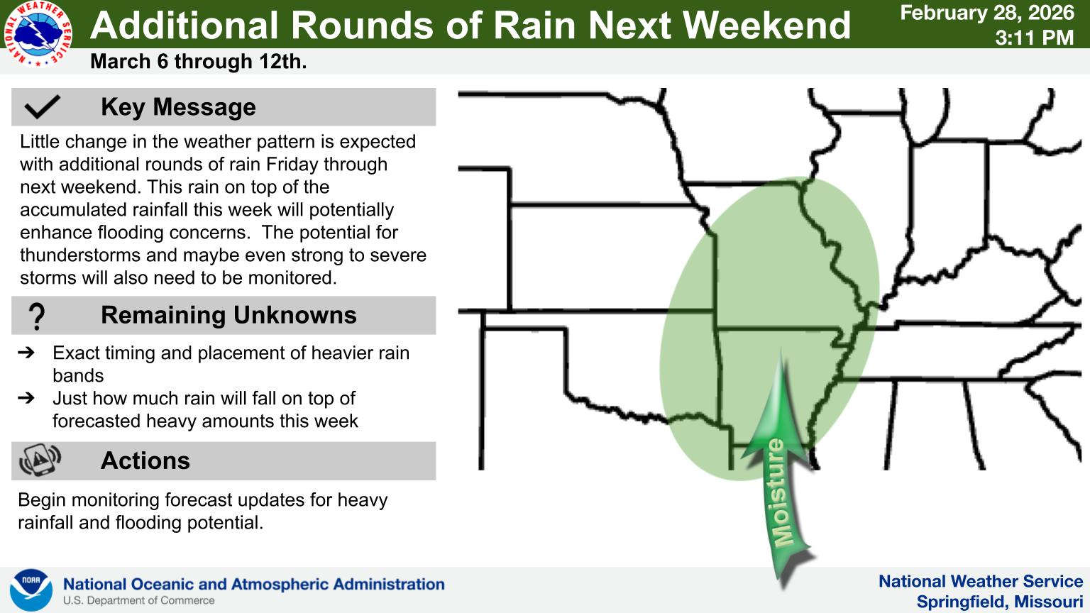
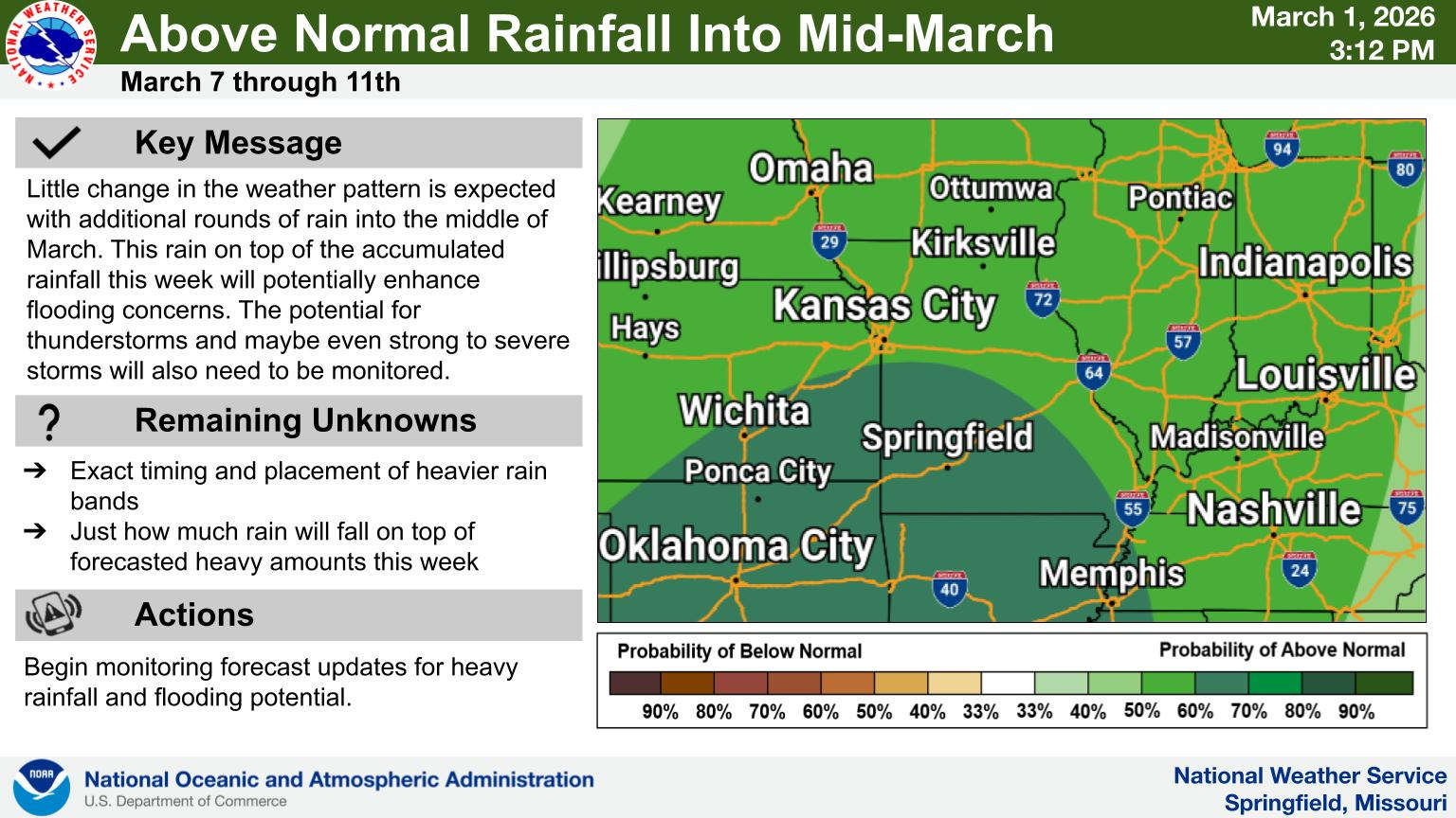 Rainy Pattern in Place, Severe Storms Possible Later This Week
 Early Voting Last Day, Primary Election Tuesday
 Rain Pattern Continues Through the Week
 Thousands Attend Service for Fallen Deputies
 Judge Latest Arrest in Investigation of Boone County Public Corruption