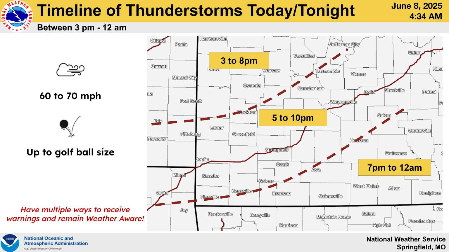
The off and on storm activity will have one more on period before moving out of the area early Monday morning.
After a mostly dry day in the Lakes Region, the National Weather Service indicates that a final surge of storms will push through, with 7:00 to Midnight the prime time for possible severe storms. The NWS has the Lakes Region at a Slight Risk Level with 60-70 MPH Winds and Hail up to Golf Ball Size the primary threats.
While storms are possible, the NWS is not predicting long periods of heavy rain with most areas seeing under an inch of rain as the system moves through.
Rain is expected to clear out early Monday morning with the next three days expected to be try with near normal temperatures.
 Hotter Today but Cooldown for Wednesday UPDATE
 Employees Still Waiting to Hear From Branson Tri-Lakes Newspaper Management
 Informational Meeting About Fire and Police Tax Thursday
 Tick Season Is in Full Force
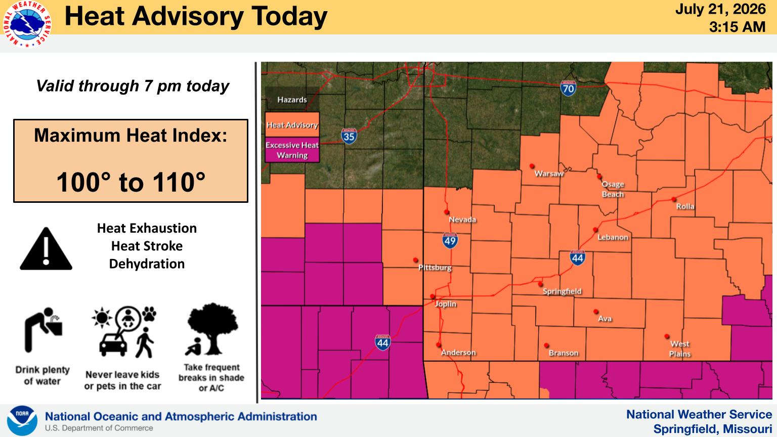
 What is the Potential Heat Index Readings for This Week? Update


