
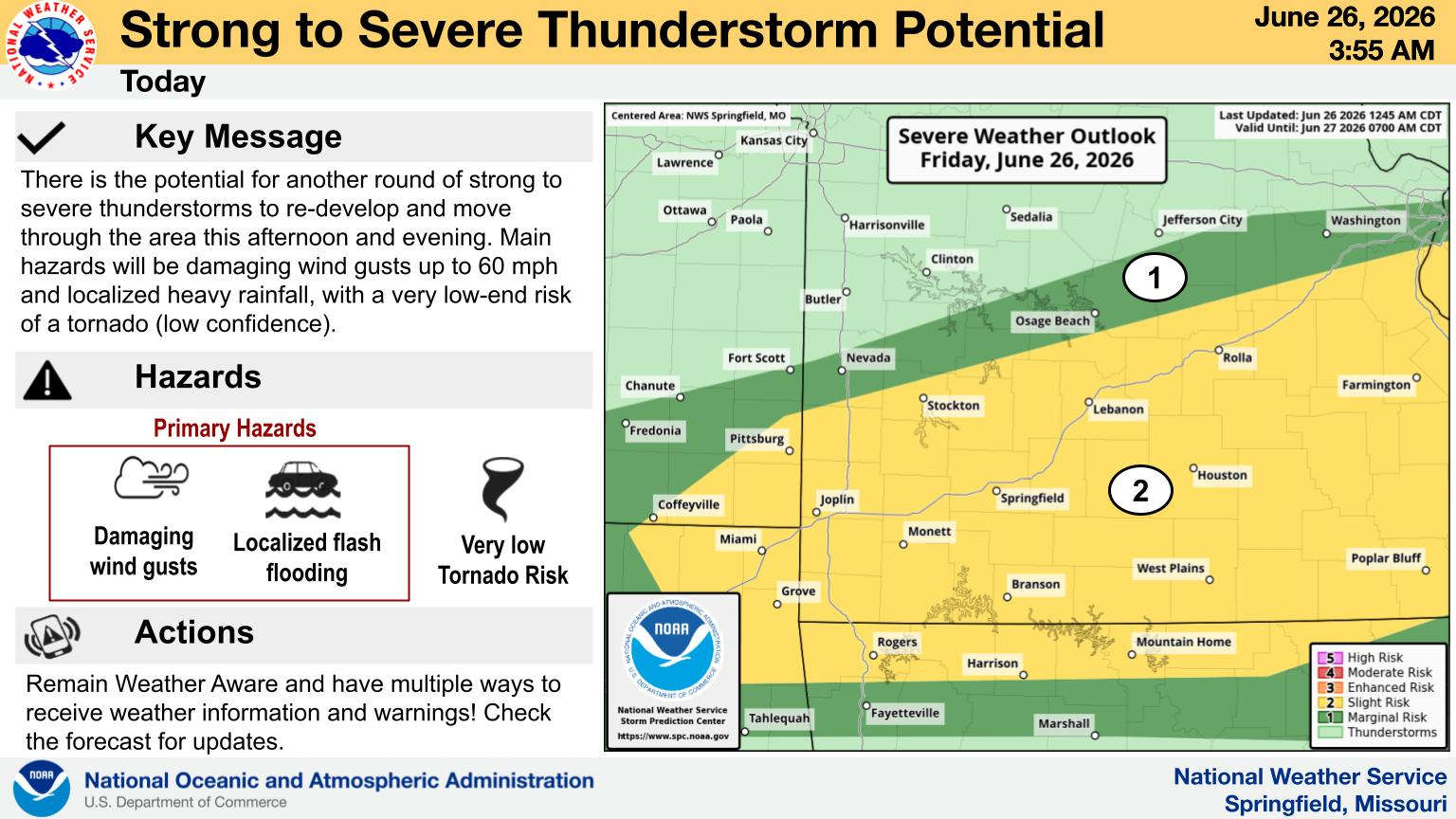
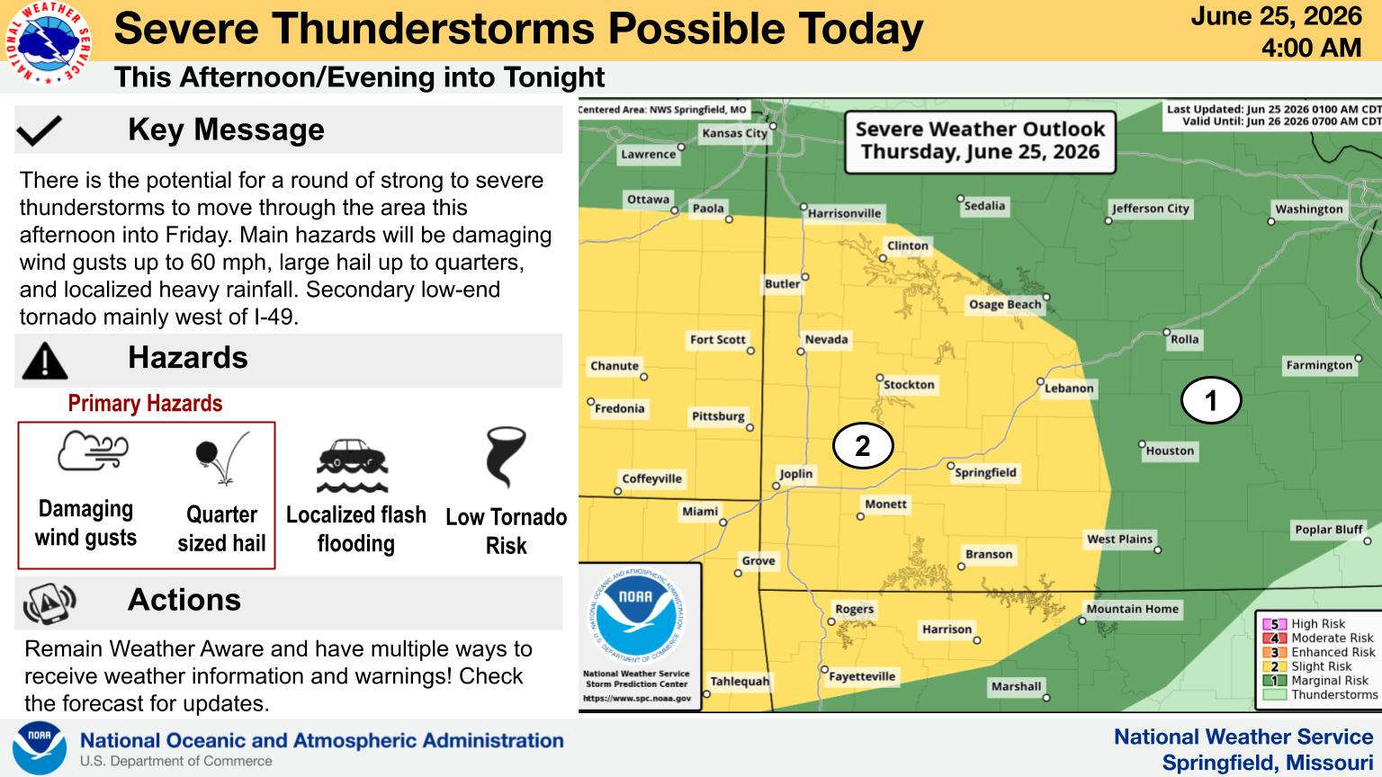
While much of southern Missouri and northern Arkansas had a quiet Wednesday evening, areas around the Missouri/Arkansas Boarder experienced around of severe thunderstorms.
Severe Thunderstorm Warnings were issued over a two-hour period which saw more reports of hail around the Lakes Region, including an inch and three quarters sized hail reported near Kimberling City. Heavy rain in the region also caused a Flood Advisory to be issued for the Lakes Region into early this morning which in Southern Stone County, was later upgraded to a Flash Flood Warning as a storm became stationary near Kimberling City.
While the severe weather stayed north of the Missouri-Arkansas State Line, some areas of small hail were reported in Carroll County late Wednesday night.
Scattered showers are expected in the area over the next couple of days with a more general area of showers and thunderstorms developing Friday night into Saturday.
 Boil Order Issued for Area Water District
 When the Rain will End and Hot Temperatures Arrive in the Lakes Region?
 Harrison City Council Gives Initial Approval to Placing Sales Tax on Ballot
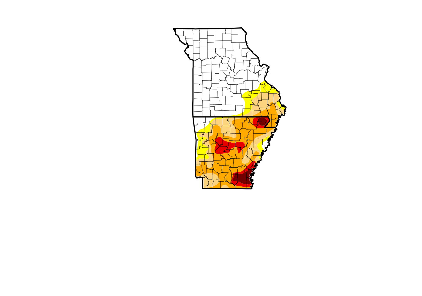 How Much More Drought Levels Have Dropped Due to Continued Rainfall
 Flood Watch Extended into Lakes Region, Severe Weather Possible


