UPDATE: The National Weather Service has issued a Tornado Watch until 7:00. The Watch includes most of the Lakes Region including areas around Branson, Kimberling City, Harrison, and Eureka Springs.
Counties in Arkansas include Boone, Carroll, Marion, Newton, and Searcy Counties.
Counties in Missouri include Barry, Stone, and Taney. The watch also includes the Metro Springfield area of Christian and Greene Counties.
After a brief break Saturday evening, another round of rain is expected in the Ozarks today going into Monday.
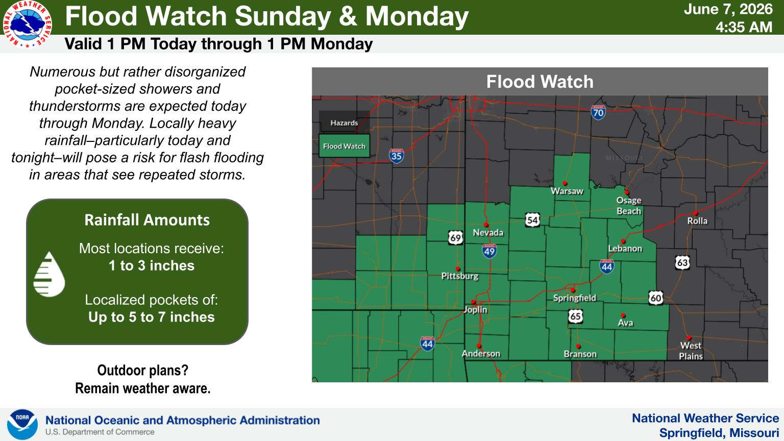
The National Weather Service has issued a Flood Watch for the Missouri Lakes Region starting this afternoon and going into Monday afternoon.
The rain is expected to redevelop early this morning with possible rainfall rates of 1 to 3 inches per hour which may lead to flash flooding in urban and low-lying areas. Rainfall amounts overall of 1 to 3 inches are possible with locally higher amounts possible.
According to the statement from the NWS, excessive runoff may result in flooding of rivers, creeks, streams, and other low-lying and flood-prone locations. Flooding may occur in poor drainage and urban areas. Low-water crossings may be flooded.
NWS Forecasters also add that some brief, isolated severe storms possible however the biggest threat for these storms is the potential for heavy rain and flooding.
 Showers and Thunderstorms Today, Give Way to Heat This Week
 DOJ to Award $300 Million to Model Cities Dedicated to Restoring Law and Order
 Harrison Police Receives Thanks for Assistance in Arresting Missing Teens from Tennessee
 CBCO Blood Drives Coming Up In Lakes Region


