

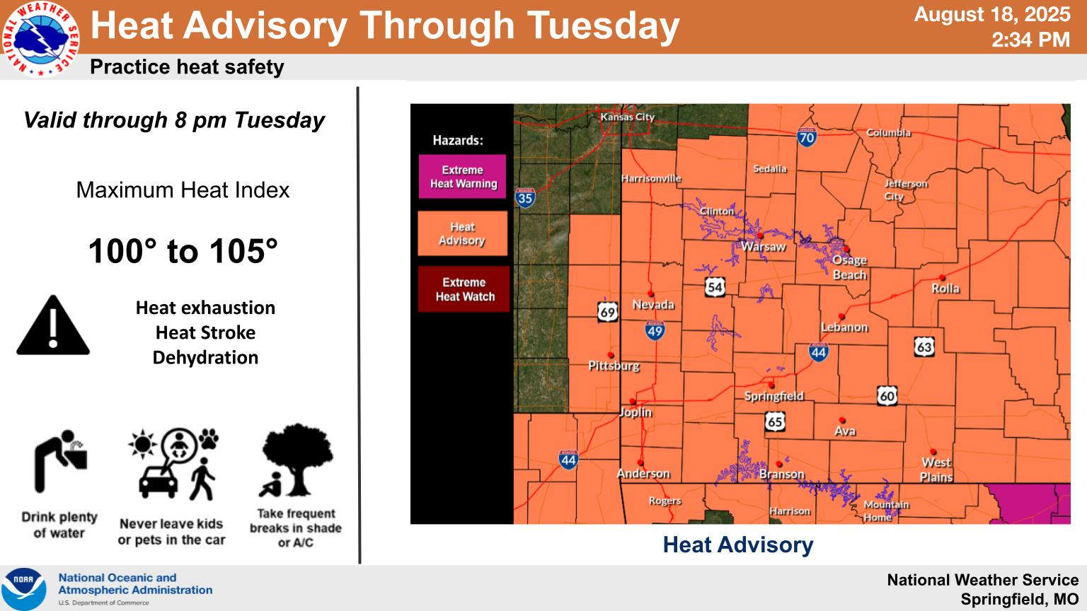
The National Weather Service has extended the Heat Advisory through Tuesday for much of the Lakes Region.
All of southern Missouri including the Branson area as well as areas around Harrison and most of northern Arkansas have seen the advisory extended with high humidity keeping Heat Index Readings between 105-108. Isolated rain chances also continue for the region.
Just as the Heat Advisories were being extended on Monday, some storms popped up in the Lakes Region. Reports to the NWS Office indicate a 55 MPH Wind Gust was recorded north of Branson around Walnut Shade while in the Spokane area, a downburst wind caused some tree to block Goff Creek Road.
Storms were strong enough to cause a Severe Thunderstorm Warning in areas south of Berryville in Carroll and Madison Counties, but no reports of damage were submitted to the NWS.
Meteorologist Ben Price with the National Weather Service Office in Springfield, during an interview Monday on KRZK's "Ozarks Now" program, said that while this third heatwave has been the hottest one this year, it has yet to set any record highs, though the impact of the extended dry and hot period has begun to increase drought levels in the region.
Price added that a front moving through on Wednesday will begin to gradually drop temperatures with the extended forecast into September projecting for conditions to be close to normal with both temperatures and precipitation.
The complete interview with Ben Price can be heard below:


 Primary Election Day
 Severe Weather Threat for Lakes Region Increases for Wednesday, Friday
 Harrison Man Charged After Pursuit in Baxter County
 Rainy Pattern in Place, Severe Storms Possible Later This Week
 Early Voting Last Day, Primary Election Tuesday