Another day that sees the Lakes Region once again under a Heat Advisory could end with strong to severe thunderstorms moving through the region overnight into Wednesday.
Temperatures will once again climb to the upper 90s to around 100 with Heat Index Readings from 105 to 110.
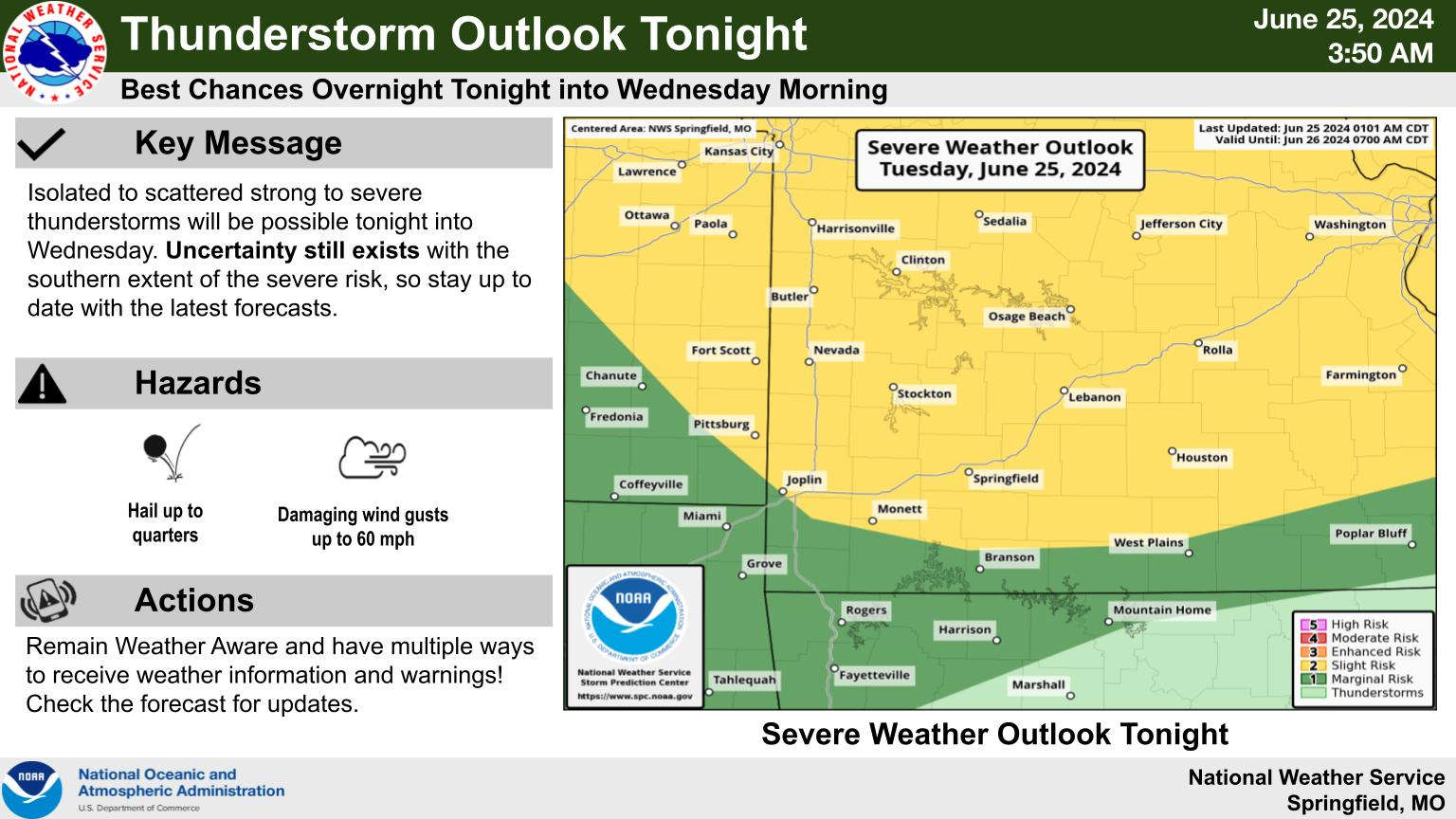
A frontal system will move through the region overnight that will bring a chance of showers and thunderstorms. Most of the Lakes Region is at a Marginal Risk with hail and high winds the primary threat. Areas just north of Branson will have a slightly higher risk of storms while areas south of Harrison will have a slightly lower risk.
The front will cool temperatures down to the low 90s for a couple of days before surging back to the upper 90s by Friday.
 What is the Potential Heat Index Readings for This Week? Update
 Warriors Retreat Holds Ribbon Cutting
 Lettuce Recall Continues, Expands
 Harmon Fire Department Awarded Matching Grant
 U of O Northark Movie Night Features Movie in Star Wars Series


