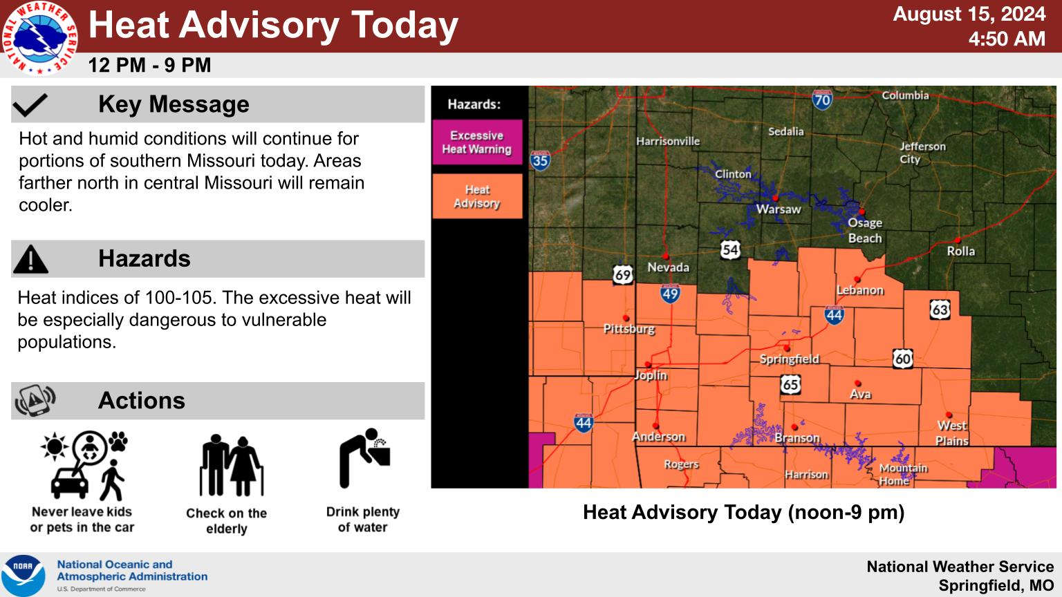
The National Weather Service has issued Heat Advisories again for today with the entire Lakes Region expecting Heat Index Readings from 105 to 110 with actual temperatures also approaching 100.
A front will move through the region this evening bringing a chance of scattered thunderstorms. The area is in a marginal to slight risk of severe thunderstorms with high winds, large hail, and brief downpours the biggest threats.
While temperatures will cool slightly, highs are expected to stay in the 90s for most of the upcoming weekend.
 Hotter Today but Cooldown for Wednesday UPDATE
 Employees Still Waiting to Hear From Branson Tri-Lakes Newspaper Management
 Informational Meeting About Fire and Police Tax Thursday
 Tick Season Is in Full Force
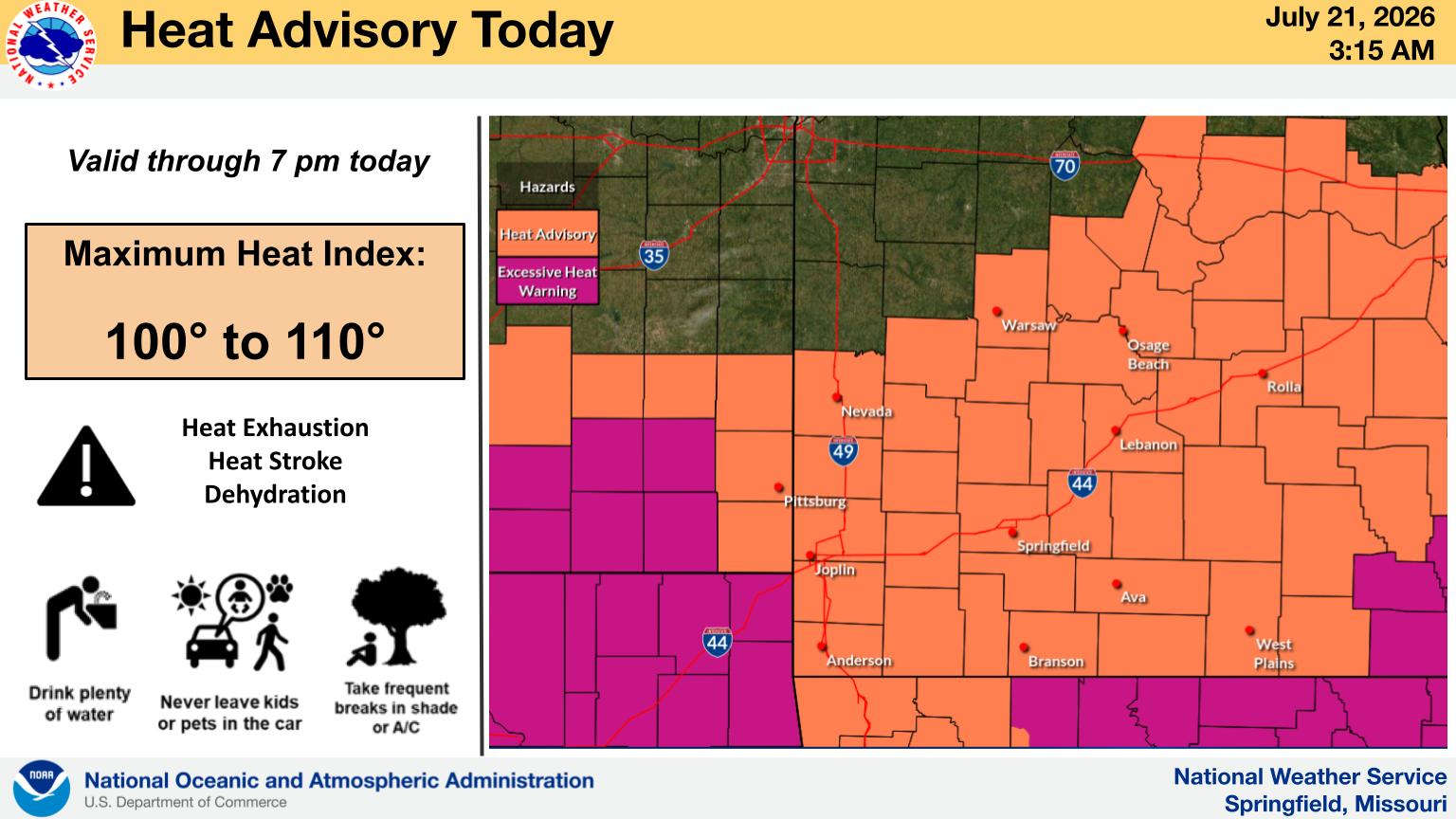
 What is the Potential Heat Index Readings for This Week? Update


