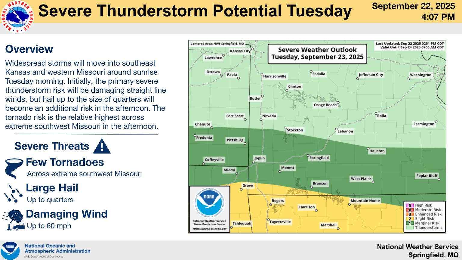
A potential for more substantial rainfall is coming to the Lakes Region Tuesday.
The National Weather Service has issued a Flood Watch for the entire lakes region from early Tuesday morning into Wednesday. Forecasters predict the heaviest of the rain will be in northern Arkansas where two to four inches of rain is predicted with possible higher localized amounts. Southern Missouri may get slightly less rain but still one to three inches with localized higher amounts are possible.
Some severe thunderstorms are also possible with a Slight Risk predicted along the Missouri-Arkansas Border and areas south while the rest of southern Missouri is at a Marginal Risk. Some tornados are possible around and south of the border while the whole region could see hail and damaging winds of 60 MPH and higher.
 What is the Potential Heat Index Readings for This Week? Update
 Warriors Retreat Holds Ribbon Cutting
 Lettuce Recall Continues, Expands
 Harmon Fire Department Awarded Matching Grant
 U of O Northark Movie Night Features Movie in Star Wars Series


