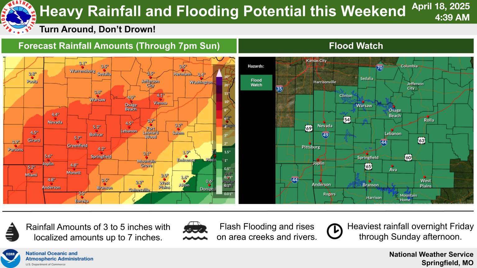
The National Weather Service has issued a Flood Watch for the Lakes Region beginning tonight and running through Sunday.
Rounds of showers and thunderstorms are expected to occur during the Easter Weekend accompanied by a slight risk of severe weather each day. Hail and damaging winds are the biggest threats with the storms.
Rainfall projections are for around three and a half inches on a line between Branson and Eureka Springs with higher amounts northwest of that with slightly less amounts southeast of the line including the Harrison area.
 Burn Bans Accompany Low Water Conditions
 Law Enforcement Seeking Information on Deadly Beaver Lake Accident
 Murder Suspect Arrested in Lakes Region Identified
 Front Storms Area, Brings End to Heat
 Springfield Murder Suspect Arrested in Lakes Region


