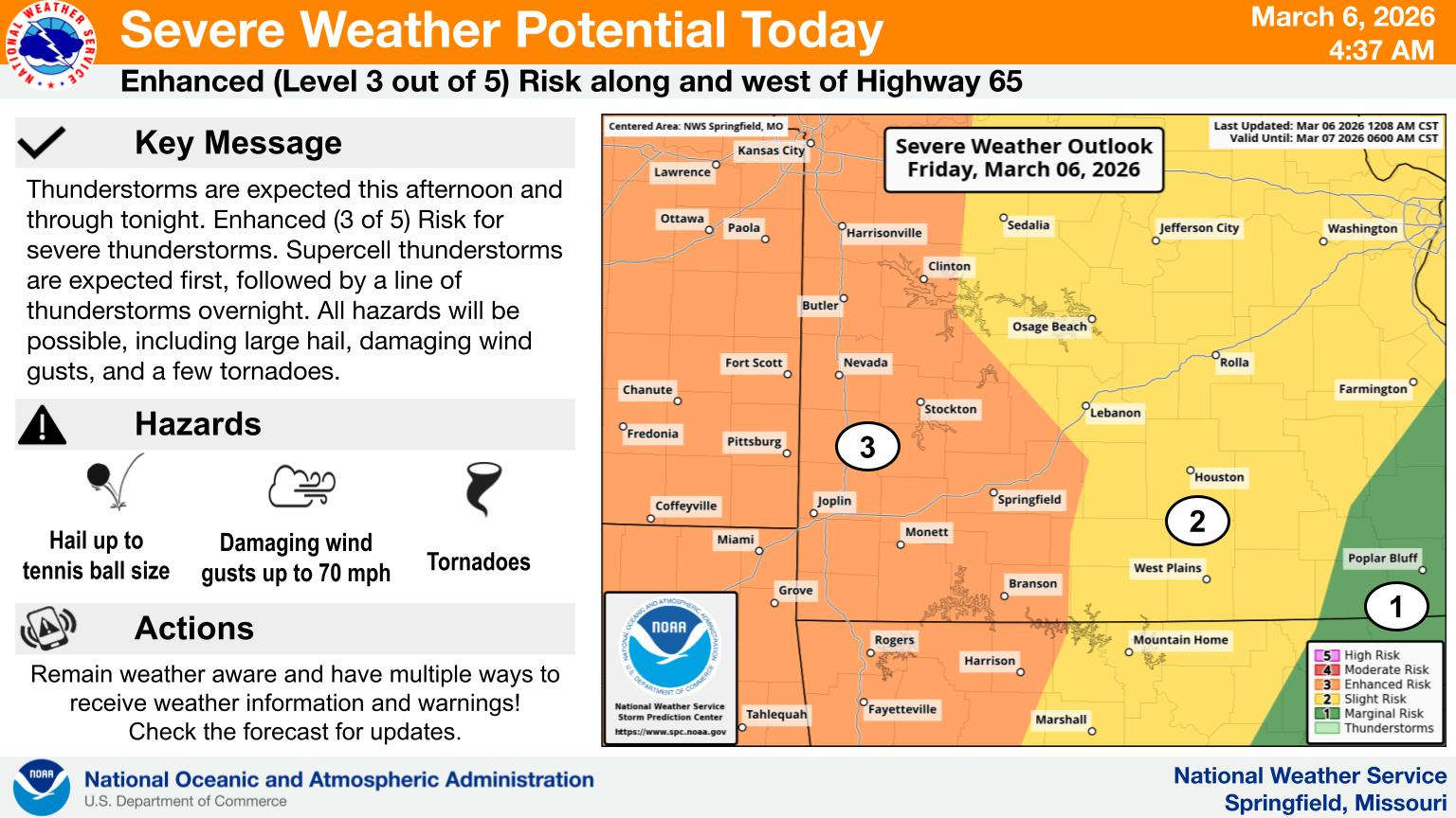
Two rounds of active weather are in the forecast for today and overnight.
According to information released by the National Weather Service, the Lakes Region is at an Enhanced Risk for all modes of severe storms including hail, strong winds, and possible tornados. Areas of heavy rain are also possible.
The first wave will be in the form of supercell thunderstorms which will move through late this afternoon into the evening followed by a squall line that will come in late tonight and overnight as part of a cold front.
The cold front will cool things down for Saturday as the rain moves out with highs in the 50s and lows in the upper 30s before things warm back up for Sunday.
 Law Enforcement Seeking Information on Deadly Beaver Lake Accident
 Murder Suspect Arrested in Lakes Region Identified
 Front Storms Area, Brings End to Heat
 Springfield Murder Suspect Arrested in Lakes Region
 Final Hot Day Ahead of Front Bringing Cooler Temperatures, Rain


