The National Weather Service continues to update information on showers and thunderstorms hitting the Lakes Region over the next several days.
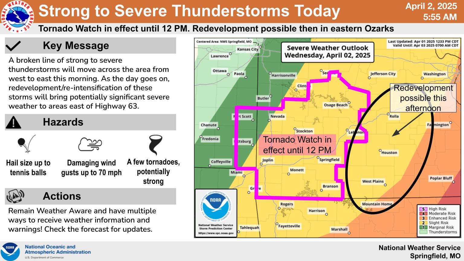
Forecasters have issued a Tornado Watch for the region until 12:00 for the Branson Area including Taney, Stone, Barry, and Christian Counties in Missouri along with Carroll and Madison Counties in Arkansas. A line of storms will push their way through the region this morning potentially producing hail in addition to tornados. Winds are gusty ahead of the storms with gusts up to 45 MPH possible. As the storms pass through the Lakes Region, parts of south-central Missouri and north central Arkansas could see even stronger storms this afternoon.
The chance of severe weather continues Thursday with forecasters predicting the potential for heavy rain continuing into the weekend. Most of the Lakes Region including both the Branson and Harrison areas are under a Flood Watch starting this afternoon in Arkansas and Thursday in Missouri with the possibility of three to five inches of rain area wide with isolated amounts up to 10 inches.
 Informational Meeting About Fire and Police Tax Thursday
 Tick Season Is in Full Force
 What is the Potential Heat Index Readings for This Week? Update
 Warriors Retreat Holds Ribbon Cutting
 Lettuce Recall Continues, Expands


